Thursday, April 7, 2011

Dune grass greening up

Winter wind has deposited new sand on the dune top and fore dune. The buried European Beach Grass is responding by quickly greening up and soon the grass will be lush and growing thick. As noted before, the dune top/peak is 3-4 feet higher than last year and quite noticeable. If your walking on Discovery Trail from the Seaview Beach Approach to Beard's Hollow, you can see the back side of the new dune height from the trail.

The height addition and slope of the fore dune make it pretty steep to ascend as the sand is still loose and soft so be careful!


Tuesday, April 5, 2011

Cleveland Rockwell: Fisherman Driven Ashore

Another great Cleveland Rockwell painting. I'm pretty convinced that this painting is of the old Chinookville/Chinook Point/McGowan village sand bar area just upriver from Fort Columbia. That dark headland in the distance is a dead ringer for Cape Disappointment. Squalls would rise quickly in the Columbia River and Ocean area, putting fisherman at risk of loss of boat or life. The Book "Chinook by the Sea" (available in Ilwaco TRL library) tells tales of many fisherman lost at sea due to brutal storms. The fisherman were usually buried along Baker's Bay where they were found. The Cleveland Rockwell exhibit will be from May (20th) through September of this year (2011) at the Columbia River Maritime Museum. Here's the CRMM link:   http://www.crmm.org/maritimemuseum_exhibits_upcoming.html

Monday, April 4, 2011

Cleveland Rockwell

Cleveland Rockwell was a US Coastal surveyor out of Portland in the late 1800's. He did some fabulous surveys in the Pacific and Clatsop county area, particularly along the Columbia River.

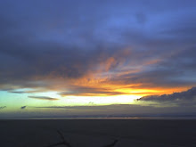
He also painted landscapes. This painting was titled "Weather Beach". When I first saw it I was amazed, there's North Head without a lighthouse and there's Beard's Hollow looking pretty in the afternoon sun. The ship on the horizon is crossing the bar on a following wind perhaps. That big landslide is also visible above the stagecoach and is still visible today. The perspective also got me interested, perhaps he was on a large piece of driftwood, shipwreck or large rock? above the beach? I've checked out this picture from the beach many times, trying to find the right spot where I think he painted the coast from and I'm pretty sure that it is North Head. He also did another great painting of another local area that I'll post as soon as I find it.

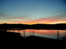
I always liked the name "Weather Beach", as in "Oysterville-Weather Beach Road" or "Tarlett-Weather Beach Road". The beach we live on is where the weather hit first and thus it was the beach of storms, wrecks, stranded men, brutal winter winds and rains. Shipwrecked men, cast on to the beach, to struggle to find anyone at all to save them from exposure, starvation, thirst.

Yet by the time Rockwell painted the above image, the beach was changing fast, becoming a rural area with stage coaches, docks, wharves, soon a train, then roads. In a 3 generations from Robert Gray (1792) and the Lewis and Clark Expedition (1805-06), the beach would change forever.

The Columbia River Maritime Museum is going to have a showing of Rockwell's paintings sometime this year. Stay posted!

Thursday, March 31, 2011

Fire wood profiling


Decades ago, particularly in the 60's, wood gathering was really fun. Lots of log rafts on the Columbia River, log barges and log ships losing part of a deck load now and then and miles of beach meant that Saturday's were spent with Dad and friend Ed Chelis hunting down nice logs.  You could have your pick and as the commercial log salvage was pretty none existent, we could pick of any log we wanted. By the age of 12 I could hop out of truck, take a few whacks at a log and know it if was desirable fir or less desirable hemlock or other mystery tree like spruce. I walk a lot on the beach in the late afternoon and nowadays I get to watch modern wood gathers do the strangest things. There isn't as much choice now and any good log will burn given enough drying time. The above pic represents a sort of modern profiling where the wood cutter took one cut right through the middle of a nice hemlock to figure out the wood type, then decided to not cut any more.

Or this one where the woodcutter(s) take a whack and that's not good enough and then cut then end off the hemlock and that's not good enough. This log was 1/2 dry and would burn nicely on a cold February morning when it's the olny wood available, but no..got to have that fir!

But sometimes, there is not satisfying even the most discriminating wood cutter and here's a whack out of nice piece of fir. Nope, not good enough. Got to get back in the truck and look for wood 'cause when you are wood cutting on the beach, it is all about looking for wood.

Tuesday, March 29, 2011

You Are Here


The tsunami in Japan gave us that live along the beach in southwest Washington a reality time kick in the ass. Here is a LIDAR (Light Detection and Ranging) image that utilizes lasers to measure topographic detail from an airplane. Red is bad and purple to white is good. From our house Dian and I have about a 8 minute trot (well..make that a fast trot) to high ground that gets us above 4o feet. The Japan tsunami crested the tops of beach front trees in some areas, such a tidal wave in our area would sweep well inland. The best way to deal with an event that occurs on a cycle of hundreds of years is to get your mind around the fact that if the earth shakes and the Cascadia Subduction earthquake cuts loose, head for the nearest high ground on a route you've already practiced on.

Sandhenge

Beach walking is great for my health and very entertaining for the mind. It is not unusual to run across ephemeral beach art. Here we see a creation of sand, sticks and the lone claw of a Dungeness crab. Perhaps the central column was taller and the wind eroded it, perhaps the there was a gate entrance to the ramped conical tower. Perhaps this is an temple to the crabs. Or mere whimsy from the fertile mind of a child.

Sandhenge stayed around at the very high tide line for about 3 weeks until we hit a run of high tides and storms.

Dune Blows

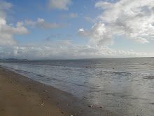
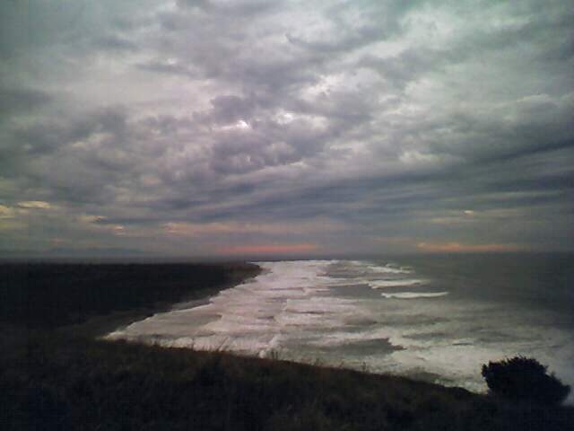
I've been walking along the fore dune and ocean beach frontage of Seaview pretty frequently and have noticed the dramatic growth of the dune top this winter. Nearly 4 vertical feet in many areas, new sand blown in this winter has created a very peaked effect.

Equal if not more dramatic are the gap trails and roads, many have grown well over 8 feet high at the immediate area slightly behind the foredune by the local venturi effect of wind blasting through the gaps, then settling down in large mounds immediately behind the fore dune. While they make walking out to and back from the beach a bit more difficult, the loose soft sand makes it nearly impossible for 4wd vehicles to climb the fore dune face. This is a good thing.

Followers

About Me

My photo
Seaview, Washington, United States
I live a mile from where I was born but sometimes I feel like a stranger in my own strange land. Descendant from gold miners (The Yukon and Mexico), coal miners (Wales, British Columbia and Washington), timbermen (Sweden), sod and berry farmers (Missouri, Washington), Klondikers, fortune seekers and just plain hearty peasant stock.