Tuesday, November 3, 2009

Dead Birds


In a former life as grad student studying seabirds in the Channel Islands I saw a lot of dead birds. In 1980 we lost virtually 95% of the Western Gull chicks due to a very hot day when the wind layed down and literally cooked them on the spot.
That summer I bemoaned to one of my faculty advisors, John Smiley, that the only constant out there was change and how the hell could we expect to incorporate such change in a Master's or PhD thesis given the short (a year or two) data window.
The recent biologic storm that resulted in thousands of dead birds along the coast of the Pacific Northwest is just a reminder that death happens. A convergence of events can, in an ecological sense, do excatly the same thing to wildlife as a convergence of events that bring down an airliner, sink a ship, cause an auto accident or the loss of a space shuttle. At the end of the day, there is really not a whole lot that we can do about such events, particularly in ecosystems and more so in oceanic ecosystems.
Photo Credit KCBS.

Thursday, October 29, 2009

Social Networking...Arghhhh!


Apologies for being off the blog for so long. Just the way it is. In the beginning there was email, then Twitter, then LinkedIn, then Facebook. Sometimes I think a string and two tin cans is better.
Dian and I were coming back from Ellensburg and we were going to go Chinook Pass but that morning there was a bad slide outside of Naches and we came back via White Pass.
Nice view of Rainer at the overlook west of the pass. Beautiful day.


SR 12 over White Pass was designated a Scenic Byway recently and it's easy to see why.

Friday, April 24, 2009

Taking out the trash and "bearing" it

Taking out the trash and "bearing" it


BEFORE

Bear with me here. Nothing disrupts an early spring or summer day more than walking out to your trash bin only to discover that it has become a buffet for a bear (Black Bear) or big dog. There you are at 7 am in your sweats, robe, suit, or whatever and picking up stinky old this and that and tossing it back into the bin in hopes that the sanitation truck will come before the bear does. I got so good at detecting our Serena's tone of bark (she's a really big Border Collie) that I knew, I just knew, that in the morning, I was going to spend 15 minutes chasing down the trash that a bear (possibly big dog..but most likely a bear) spread all over the neighborhood.

I was bemoaning to Ilwacoan Truman Rew about the situation and how I was debating between putting the bin in a Fort Knox style enclosure or padlocking the bin lid shut. Truman said, "no big deal", "just go down to Dennis Company", "buy a hasp and put it on", and "the bear will knock it around like a soccer ball and give up".

So that's what I did. I bought a hasp, bent it to fit the bin, used a piece of scrap Trex (plastic wood) and wood 2 x 4 to secure the hasp and lock and most importantly, tested it to make sure that the hasp hangs free when open (important detail). As our bin had a crack in it, using backing material helped fix that too.


Here's a pic of the hasp in place. A narrow piece of Trex fit nicely between the lid and bin proper. I used short deck screws to fasten everything. The 2 x 4 is inside the bin and also fixed the crack.


This pic is of the hasp hanging free, an important detail not to be overlooked.


BIN vs Bears&Dogs: Ah, the bin rests victorious, asleep after a long brutal night of futbol with the bears. Better yet, score to date:
Bin 2 Bears&Dogs 0


The downside.
  1. 1. IF YOU FORGET TO UNDUE THE HASP ON TRASH DAY...THE LID WILL NOT OPEN. Now you are under a week long trash siege and your spouse will be P.O.'d. This has happened to us twice in a year (oops). The truck drivers are smart and they'll see that your hasp is locked and the bin stays put.


  2. PENINSULA SANITATION will "officially" tell you it voids your contract on the bin as you've modified it. Unofficially, and off the record, they don't like garbage spread all over hell and gone either and they are sympathetic to the cause. ALWAYS UNDUE THE HASP. In my case, the bin was splitting apart and my repair job will add years to the life of the bin (as well as keep bears and dogs out).


  3. Your neighbors will wonder why you feel the need to lock your bin (actually, it might keep unwanted garbage from appearing in it as it does take a little extra effort to open it up).


  4. IF YOU FORGET TO UNDUE THE HASP ON TRASH DAY THE LID WILL NOT OPEN..get the picture.

And one more thing...Black Bears are very very strong. If they really wanted to, they'll open up a car like it was a paper bag so ultimately, this bin fix is as only good as the bear's willingness to give up after a few minutes, which has been the case. There is a lot of food on the beach and the bears are opportunists. That which is easy, they'll go for, that which is not so easy, they'll make an attempt.

Years ago I was in Yosemite National Park at the Ilwahnee lodge..and the NPS kept a nice little photo display of how Black Bears deal with cars that have food inside of them. Scary.

Monday, April 20, 2009

Of taking out the trash, Bald Eagles and River Otters.

Taking out the trash.

Where else but here is there such a glorious view for such a mundane task! Here is Patty bagging away as visitors stroll along and enjoy the beach. Saturday was the perfect day for gathering up debris.


Vacationers hiked from both ends of the beach as we gathered the remains.


Patty and Diane doing the good work as they collect and stack debris.
Darren and the flying kelp. There is alwasy adventure on the beach! A little known fact. Kelp will fly if persuaded. Bull Kelp is usually found resting in large tangled piles with their feet all wound up. To make kelp fly you've got to cut them loose from each other as well as cut their single foot off. Then the gas in the bulb will allow the kelp to rise into the air. This can be accelerated with the aid of any 17 year old teenager with a good arm.
Darren observing flying kelp as it wings its way low over the dunes. A rare view of kelp in the wild. Notice how it is looking down as it searches of another good place for a nap.

The point of all this is that on Saturday, the Friends of the Columbia River Gateway (the 501-c3 that runs the LCIC bookstore and North Head store and donates proceeds to Long Beach Area State Parks) participated in the Grass Roots Garbage Gangs beach cleanup.


Participants were located in local tavs, bars, and watering holes. A cruise to new lands was the bait and a free trip to the Pacific was the hook.

Most eagerly hopped on board, a few weren't so sure and clung to the sides just in case they needed to make a quick get away.


Shanghaied in the end!

The "Friends" have adopted Benson Beach and soon Waikiki Beach as our ward and so we bagged trash from nine to noon. Here we are in the largest piece of trash. A fiberglass lifeboat that has been on the beach for quite a few years. It's not going anywhere and is sort of what visitors might expect to find..an seagoing artifact truly "beached".

One of the most interesting "natural" trash events we spotted was the immature Bald Eagle pondering a breakfast of California Sea Lion. Eagles are opportunists, carnivores and scavengers and in the latter, they tend to be as gross as Turkey Vultures when they dive into a morning snack of well aged marine mammal. Makes one want to gag. No need to bag that as it is part of beach ecology.

This brings up an important point. Dead things need to stay on the beach (well..whales and seals, sea lions, etc..not humans) and not be buried, blown up or hauled away. Why leave them there? They area much a part of the ecology of our area as the living organisms. Benson Beach is a natural beach (aside from the accreted land). Crows, vultures, eagles, gulls, insects, etc. all feed on such dead animals.


Otter tracks were spotted as well, based on the size, I'd guess these to be River Otter (not uncommon for our area). I know that a couple of Sea Otters have been spotted in our area earlier in late winter but these tracks appear smaller than Sea Otter.


We salute the trash picker uppers of The Beach!

For those statistically minded, we found substantially less trash than 3 months ago, I'd say about 25% or 300-400 pounds. Tires were still common (4) but mostly we found rope, water bottles, and misc pieces of plastic debris from the tiny to garbage can sized. Nothing totally weird or unusual.v

Monday, April 6, 2009

Alien Invasion with Tequila II

Alien Invasion with Tequila II

Just a note. The Yucca comes from the Agave family of plants. This group of plants is well adapted to the hot dry desert areas of Central America, Mexico, New Mexico, etc. and many Yucca's are grown as ornamental plants. Being naturally tough..particularly on dry sandy soils, as well as having the ability to survive freezing temperatures, no surprise that they are grown as ornamentals throughout the Pacific Northwest..even though we aren't in their natural range.

Agave's include (Yucca's) those that are distilled (with the worm) into a....liquid that is a favorite refreshment of thirsty revellers... The Blue Agave (see http://www.itequila.org/made.htm) is the source of the refreshing drink (and some memory loss). Thus my play on words. I'll take some photos of Yucca's (and palms) that are growing here on the peninsula as ornamentals.

Come to think of it though..if the rain disappears here and I've choice between drinking saltwater and Tequila..well, maybe those Blue Agave's would survive here. The moth's the real issue (moth pollinated).

What Kathleen and I found fascinating was that this plant was feral. What this speaks to is the domestication of our local environments by the collision of two forces. Humans (and our penchant for gardens) and available habitat for non-native plant species (or animals for that matter). A warming earth would theoretically expand the range of such plants..but for the plants to truly undergo a range expansion..the pollinators also have to expand (like bats and moths) otherwise..no plant sex and they must withstand other impacts (disease, herbivores, etc.).

See my earlier posts on European Dune Grass. The Yucca was growing in a "sea" of European Dune Grass. Now isn't that fascinating as in where am I?

Jim

Wednesday, April 1, 2009

Alien Invasion With Tequila

Alien Invasion With Tequila
So I'm hiking out from Beard's Hollow with Sue Cody and Alex Pajunas from the Daily A and we're talking about Discovery Trail and how cool it is. As we get to the beach, the trail turns north and we do the same. We ran in into Gerry Shields, nursing a repaired knee into health by taking a long walk south from Seaview. The Turners zoomed by on bikes and other families with their kids. As we walked along I spied this plant in the dunes:


I'm thinking..what the hell is that? Looks like some palm or something that should not be there. Of course, no camera and Sue's wasn't working as well. Anyway, went home, emailed Dave, Kim and the sister Kathleen and let them know strange things are afoot and that if this is global warming, then there's no need to move to Hawaii or Arizona for that matter.

Kathleen calls me immediately and she's got to see this thing and so we hike out and she's dumbfounded. "Mother of God, Like Holly Cow!" and a more prosaic "What are you doing here?". Then "It's a Yucca" as in "You know, like Tequila".

We stand before it, awe struck. Speechless. What the hey? Is this a Sign Of Things To Come or are we entering Gabriel Garcia's twilight zone with a special twist (with lime) for ecologists? Are there more out there?


Then we dig around in the sand and find the top to a disposable soft drink container right near the root wad and some netting that oranges would be sold in and pretty soon it dawns on both of us that this Yucca got here in a storm, was tossed over the dune edge about 30 feet and landed in that soft fine sand that follows a storm. It was probably an outcast from the Columbia River after a flood or as Kathleen says, somebody flipped it over a bank and it floated down and ended up here, on the LBP dunes. And there it grew, in fine shape, possibly 4 years old.

The wind had whipped the Yucca around to a frenzy and probably damaged the trunk as a consequence, the alien invader was likely not particularly long for the world. No diplomatic immunity so we made a citizen's arrest and proclaimed 25 to life in a garden plot.

Yucca! can't believe it.


Friday, March 6, 2009

Beach Wetlands II

Beach Wetlands II


One of the great things about wetlands on the beach in prehistoric times is they were more than just wetlands, they were lakes. The land form of the beach is pretty much defined by north south dunes with swales between. The swales (wetland areas) also run north south. The swales tend to be low and very flat. That flat profile means that a fairly low head (low elevation) dam can flood a tremendous area. For example, a road about 18"-24" high that crosses a wetland can become a dike (look at a cranberry bog) and back up water in a hundred acre area. Of course, this is what beavers are so good at doing. They will build a series of dams and each dam has the capacity to raise the water level behind it 2 feet or more.

Now all these lakes had connections and with some creative portages over beaver dams and across the dunes, these connections formed an inter-dune lake system that was the backbone of travel for Chinook canoe paddlers as they traveled north and south in the lake system. In historic times, my fathers friend Ed Chellis commented that when the lakes froze north of Ocean Park, it was possible to ice skate from Ocean Park north towards Oysterville, then take off your skates, walk over the dunes and be in Oysterville. I've looked at the wetlands north of Ocean Park and sure enough, the wetland that is defined by the WPA ditch drains a wetland that connects north to Surfside (behind the golf course), then a short crossing over dune puts you in another wetland (Skating Lake..nice name) that connects north towards Oysterville Weatherbeach Road. During the cold weather in the late 60's, my family would join other families at Skating Lake for skate parties but once Surfside was built and an outfall was built to drain water away from Surfside (and towards Whisky Slough), this lake disappeared.

Tuesday, March 3, 2009

Beach Wetlands I

Beach Wetlands I

Ah..beach wetlands, by that I mean the wetlands on the Peninsula..all of them, the freshwater ones that are all over the place. My sister Kathleen and I've had an occasionally lively discussion on the pre-historic (that is like, 200+ years ago) size and make up of these wetlands.

Years ago when I was a young sprout I spent part of one summer participating in an archaeological dig up Nahcotta way yonder. Dr. Robert Shaw from WSU (he later went to Alaska from which I hear he's retired as the state archaeologist) was directing the dig as a post-doc under the tutelage of famed archy Dr. Daughtery. We were investigating a Chinook summer village located at the edge of a lake. The lake was no longer present, having been drained in historic times.

Now Kathleen's and my discussion centered around...how much water, particularly groundwater, was originally visible on the beach? Ground water becomes visible in the inter dune swales, the low spots between old (and new) dunes. Same place where cranberry bogs are as well as most of the beach wetlands.

Prehistorically speaking, the beach drained naturally through the following sloughs: Loomis, Tarlett, Giles, Freshwater, Whiskey, Paul's, and Stackpole. What might a prehistoric sloug look like? Well go to Long Island and hike the logging road from Sawlog Slough to the Cedar Grove and peer at the beaver dam that appears on the north. Beavers built a dam literally at tidewater and that day I saw it, the tide was higher than the freshwater slough! We suspect that the beach was no different, thus at every slough, somewhere near tidewater, there was a beaver dam and low..the slough was dammed up.

What that meant is that the surface water discharge was substantially slowed. When you compare that with the present day situation..in which most of the sloughs are maintained as drainage ditches as well as many new ditches added (East Main, South Main, 30th Street outfall, Beard's hollow outfall, Surfside outfalls, WPA ditch, etc.), then the water retained was likely substantial. We can never really know but I can give you examples from the historic record.

The Shaegrun Ranch was located north of Joe Johns Road (the farm house still stands). A giant hay marsh was west of it in an area later known as Espy Lake. Espy Lake appears on early USGS topo maps as a lake. Today this area is a cranberry bog but years ago it was a lake. When the crew floods the bogs during harvest, well it returns to a lake for a day.

The upshot of all this is that it is very likely that the winter time water level was at least 3 feet higher than modern times. An example would be Al Shire's comment that in early Long Beach, you could row a small boat across Pacific Avenue at Bolstad. Go to Long Beach City Hall and look east towards Culbertson park, note the dip in the land, that's an old swale. If the very able public works crew at Long Beach didn't maintain there stormwater pumping system...in January, then it is likely you too could row across Long Beach.

By the way, in the summer during a low tide, you'll notice water draining away from the beach in seeps either along the bay or ocean, that water is groundwater draining downhill from points higher.

Friday, February 27, 2009

Sustainable Table

Sustainable Table

Ever wanted an outdoor picnic table that could survive for centuries? I was at A-1 concrete in Ilwaco (formerly Big River, Dennis Company, Hart's, etc.) watching Bill Clearman construct one of our Lewis and Clark monuments and the concrete crew showed me this cool...nearly indestructible and very heavy bench. Heavy, earthy, stout, monumental, and massive but sort of cool in a Stone Henge, Giza Pyramid, Machu Picchu sort of way. Oddly enough, the simple design fits with the concrete of the WWI, CCC, WWII era, and I took a liking to it.

Of course, unless you've got a tractor to move the thing around, better find the best spot for it because you are never going to move it unless you've got ten men and a boy. It does come apart in the same way that a D-9 Caterpillar comes apart, every piece could crush you on disassembly.

Thursday, February 26, 2009

Dune Grass III

Dune Grass III


So..what will be the dune of the future? In our lifetime, as in the next 30-40 years, the dune system that we grew up with, that we all know and love, will likely become a mere shadow of its former self as it is slowly compressed into a narrow strip between the westerly advance of the Sitka Spruce/Beach Pine forest and the easterly advance of the Pacific Ocean.


The forest advances into new territory (created in the last 90 years) and the beach is no longer accreting fast enough to create new dune as we know it and it is far more likely that mean sea level rise will claim land back. Why is the sea rising? Well, for that last 7000+ years the sea has risen 120-200 feet as North America came out of the Ice Age. It more recent times, thermal mass exapansion of ocean water as well as continued ice melting will likely accelerate the trend.


What that means for Seaviewites, Long Beachians, Ocean Parkians and Surfsideians is that we'll have a much narrower dune grass environment. Those of you that doubt the rapidity of change..please recall that in my father's lifetime of 88 years, the beach accreted into its current state so in my lifetime it could certainly go the other way.


If you want a peak at what the future might hold..drive up to Leadbetter Point State Park and Wildlife Refuge and walk the beach along Willapa Bay and you will see a Sitka Spruce forest right up against an eroding beach. The one difference with the ocean side is that the wind driven salt spray and sand (with salt) will likely create a very tough zone for some plants and that might be wider, say 20-50 feet and more typical of what you might find along static beaches on the West Coast of Vancouver Island. Just south of Tofino is a beach..Long Beach of all things, and it has a very narrow grassy area that clearly ebbs and flows with winter storms pulling sand away and summer winds driving sand back up. That might be our beach of the future.

Embrace change..its whats happening.

Tuesday, February 10, 2009

Why the name "My Seaview"?

Why the name "My Seaview"?

Simple. About 8 years ago Dian and I were at Monticello and Kat Imhoff escorted us around a bit. There is a spot just east of Jefferson's home and above the garden that Jefferson called "My Seaview". From that point looking east north east, the blue cast Piedmont hills look like waves of a sea and as Jefferson had crossed the Atlantic, he clearly remembered what it was like to look off at the distant sea from the deck of a sailing craft. Kat implied that he liked to gaze off at his Seaview, possibly in reflection.

I marveled at the thought that a continent away, I too gaze west at the waves of the Pacific wondering what mystery they hold.

Thursday, February 5, 2009

Port of Peninsula and Pile Driver

Port of Peninsula, Pile Driver and Oyster Picking

Click Twice on the lower left arrow button to start the video.

Dad and I were down at the Nahcotta dock a month ago and here's Bergerson's crawler crane using a crawler crane mounted diesel engine pile driver to set steel piles for the new Port of Peninsula dock. The hammer is essentially a 2-stroke diesel engine in which the piston is also the driving hammer. You can't really see the action within the steel cage held aloft by the crane, but there is a massive single cylinder engine up there and once the crew lights her off, a lot of force is generated and it is quite loud. See this great website for a history on pile drivers http://www.vulcanhammer.info/.

These galvanized steel piles are pounded in what are called "bents" or rows of piles. Then steel i-beams are laid atop the piles and welded in place, subdecking/framing is put on the i-beams and a concrete deck is poured atop.

The piles in the video are at put in at an angle and welded to the verticle piles to stabilize the dock and they are called "brace piles" or "batter piles". The new dock replaces the old wooden dock originally put in about 1958 or so. It was on it's last legs so to speak. The port is home to over a dozen oyster dredges and many of the oysters are transferred over the dock to large trucks. When a truck backed up on the old dock and hit the air brakes, you could feel the dock shudder and sway. Docks are easily destroyed by marine vessels hitting them and here is why. A bigger boat/ship/ferry etc can way many tons and as they glide through the water, they've got a lot of motion behind that weight. This is why when a ferry's electrical switching system fails as the captain asks for full reverse...a ferry dock can be destroyed in a matter of seconds. All that weight in motion meets the dock and crunch goes the dock. This is why docks have massive fender piles and bumper piles to asorb the shock of a ship tenderly bumping it.

The new dock is bigger, stronger, and can accommodate the bigger trucks that haul more oysters that are delivered to the dock by bigger dredges. 40 years ago, nearly all (except the Robert M) dredges were wood. Today..wood dredges are in the minority. Wiegardt's "Leader" and "Tidepoint" are examples of the older wood dredges. "Tide Point" was built in at the Ilwaco Boat Works half a century ago. New dredges are metal and either steel (Hawk's Point) or marine grade aluminum (Northern for example). Just as the dredges evolved..so has the dock.

I worked on the Leader for a bit one summer, shoveling oyster shell off and then picking up tubs. Sam Slagle ran it and we all called it the "Leaner" for its pronounced lean to starboard as I recall. I also had an opportunity to be on the Tidepoint a few times. I recall that Ed Houston was the boat captain at the time and when he retired, Ernie Sadewasser was the boat captain. One time Dave Wiegardt and I were sitting on the top of the wheel house watching Bob Hunt and Allen Ray Allen pick up tubs. Ernie laid on the air horn just for fun and Dave and I just about jumped off the dredge.

Ed Houston was the bed foreman and his picking crew would go out and pick tubs in a line, Ed was very particular about lining up the tubs and carefully coiling the rope and wooden floats on top of full tubs because when the tide came in, the dredge would sidle up to the row of wooden floats floating up from the tubs and began to hoist them one by one and dump them on deck.

A bunch of us kids from the area where also in Scouts and we wanted to go the International Jamboree in Japan in '71. Dobie and Lee Wiegardt agreed to hire us on as oyster pickers so that we could raise money. Of course, we are 15 year old kids out there picking oysters with men in their 30's and 40's who have been picking most their life. Brutal work.

Ed made sure that the working man got the best ground to pick and in a tide I recall that the best pickers could bring in 240 bushels or 10-12 tubs. Us kids could barely do 1/3 of that, around 4 tubs or 80-100 bushels. At 17 cents per bushel that would be $17 U.S. per tide for us and nearly nearly 3 times that for an adult. Very hard work often defined as "assholes and elbows".

One time we were picking and Ed walks over to me and says "I see your dad's coming over". I glance up (not wanting to stand up and look around) and I see this figure about a mile off and I say "how you know it's him?". Ed laughed and said "I've been watching your father walk across the flats for 25 years and I can tell who it is just by his walk".

Once the tide came in, Ed ran the Tidepoint out to the tubs. The headman on deck called the "cowboy" threw a loop of chain into the water and around the floating wooden block. Then the boat captain would instantly winch the tub (which was full of water, mud, oysters) up, and as the tub cleared the bay, water would pour out the side strakes of the tub and he'd swing the tub on deck where the deckhand would attach a metal hook to the bottom of the tub and then the tub would be winched upside down and the oysters dumped out. The boat captain was a busy man running two winches, the main engine, the wheel, and keeping and eye out for the line of tubs.

Picking oysters was and is very hard work and tough on the body. Typically you are wearing heavy hip boots and walking in mud trying to pack a wire bushel basket filled with oysters and dump it in a tub that might be 20-50 feet away from you. In the old days, one could always get a job picking oysters but working the tides was a pain because your got up 45 minutes later every day to match the tide and your body tended to never sync with the time.

Sunday, February 1, 2009

Beach Clean Up

Beach Clean Up!

On Saturday morning, a most beautiful morning with temps in the 30's, 7 of us charged towards Benson Beach to make our contribution to the Grass Roots Garbage Gang's most noble and long-lived efforts to keep the beachs clean. This is no easy feat as whatever floats..ends up on the beach and that is not good. If you live near a stream, river or bay, if you work on a boat..please keep your trash nailed down..otherwise it floats away and we will find it. Please contact the GRGG's at their website(http://www.ourbeach.org/index.html) if you enjoy the beach and want to keep it clean.

Several of us are board members of the Friends of the Columbia River Gateway and we were very pleased to dedicate a modest amount of money and our time to assist in keeping one of our key resources clean.

We started at about 9. One team of three started at the North Jetty and the other team of four started at the base of North Head. We walked abreast and picked up literally every piece of junk we came across and finished the 1.8 mile long beach about 3 hours later.

Our efforts resulted in bagging (43 bags plus the unbaggable stuff) about 1000 pounds of trash including rope, a shopping cart, 5 tires, shoes, shotgun shell wadding, and miscellaneous plastic trash. Some items were small like plastic bottle tops, shotgun shell wadding and short lengths of rope. We found very few glass objects (only one light bulb and one fluorescent bulb) and as noted in other trash surveys..most of the trash is plastic. For the starving our finds included a quart of milk only 6 days old, a bottle of beer and an onion. If this was Lost!..well we'd have indigestion.

The weather was cold but very nice. A Bald Eagle watched us meander up the beach. Betsy's picker upper broke and she learned the hard way how painful it is to reach over and snag those small plastic things.

The State Parks crew cruised the beach as we finished up and picked up our bags of trash and stacks of junk. A few items had to be left including part of a lifeboat and rope ends that couldn't be dug out of the ground and a crab pot buried so deep it just might stay there a while. Most of the rope was cut off above ground and that is a chore as well. I'd recommend a machete for chopping rope out of wood and kelp piles.

As many high tide waves wash over the dunes at Benson, there are several areas behind the dunes that likely accumulate trash and addressing them is for another day. I and others think that we really needed 10 people to do an adequate job that would include the area behind the dune.

Hats off and we salute the Grass Roots Garbage Gang for their dedication in keeping one of our prize resources free of trash. Unfortunately..this is an ongoing battle waged three times a year.

Thursday, January 29, 2009

Dune Grass II

Dune Grass II

The once and future dunes. This photo represents the past, present, and future of the dunes. On one hand, the sand under my feet is accreted land dominated by European Beach Grass and just a few beach pine. Yet to the right is the future, that of a beach that has a forest close by the sea.


While this may be the present view on the beach, it by no means represents the likely future. The relentless evergreens, the beach pine and sitka spruce will eventually dominate and once again reclaim their rightful place in beach evolution. This will set up an epic battle between the land and sea.

Ok..let us start at the beginning and there is no better place to start than the beach circa 1900. At that time, the dominant dune grass growing on the Long Beach Peninsula was American Dune Grass and suffice to say, while it was the primary dune grass, it wasn't as dominant as present day dune grass.


This aerial photo was taken in 1926 and is looking north from present day Long Beach towards Cranberry Road. The North Jetty had been in place about 10 years and there is a pretty clean sandy beach plain without much dune grass.


After construction of the South and North Jetty and the subsequent channelization of the entrance channel of the Columbia River, the future maintenance of the channel became a matter of importance. The Clatsop Plain was a sandy and open plain spit. Someone noticed that sand was constantly blowing from the sandy plain to the Columbia River and in an effort to halt that sand movement, European Beach Grass was planted by the Soil Conservation Service. The time of this planting was post WWII as I recall reading (and I apologize not having the source documents to quote).


European Beach Grass is a much more vigorous colonizing grass than the native species and it quickly gained a foot hold on the Clatsop Plain and then spread north across the Columbia and towards Long Beach and on up the Washington Coast. The accreted lands of the North Beach Peninsula provided fertile ground for grass, thus the immense grassy swards out in front of Seaview and north were and are today dominated today by European Beach Grass by possibly 95% with the remainder the original American Beach Grass.

At first, it wasn't that dominant. This 1950 aerial photo is in front of present day Long Beach and there are patches of dune grass here and there but the sandy plain is quite dominant. The North Jetty has been in place a tad over 3 decades and it doesn't look like the dune grass (probably European) is getting a super foot hold but it is appearing.


These grassy fields or swards or I should say, the nature of them, is note known for prehistorical times. In an effort to figure out what the beach might have looked like I thought back to the late 1950's and 1960's when I was growing up in Ocean Park.


The dune area between the primary dune and back dune was a mixture of sand and beach grass, mostly beach grass with low open sandy areas that were dry in the summer and water filled in the winter. No pine trees at all. I can recall riding in the families '56 Ford Ranch Wagon and as we were headed south on SR 103 (affectionately known as the "front road" back then), I could easily see the breakers of the ocean..say in the vicinity Tides West. Hard to believe now. However, it is likely that most of the dune grass I was looking at was dominated by the European variety. And off course, few if any pine trees or spruce blocked the view.

As I grew older and armed with a lot of questions, I wondered what the original beach might have looked like. Several images kept returning to my mind. One was of the Vancouver Island outer coast. In 1983 I ocean kayaked from Tofino to Hot Springs Cove and noticed how narrow the "dune" environment was on Flores Island and Vargas island. The "dune" was narrow in many places, perhaps only 50 to 100 feet in width and then salal and more brushy vegetation took over and that was immediately adjacent to Sitka Spruce. I also remembered wandering along "Long Beach" (near Tofino) and noticed the same thing.

Years later, while working at the City of Long Beach (Washington of course) I looked at the famous photo in City Hall that depicts a gathering of city residents in front of the post office and women's reading room (now the City Hall building on Bolstad). The 1900's era photo was apparently taken looking north from the porch area and you can clearly see short scrubby vegetation of ferns, Sitka Spruce, possibly salal. I also ran across a water color by Joe Knowles' sister (name eludes me) this painting was done..possibly in the Seaview area in the 1920's and it also depicts a narrow beach dune area.

The upshot and my conclusion of this analysis is that the beach rapidly accreted post jetty construction and then the sandy plain was taken over and dominated by European Beach Grass..then Beach Pine and Sitka Spruce are slowly taking over. This process is actually pretty quick and in my lifetime, that is in the next 30-40 years, the grassy swards behind the fore dune will make this transition from somewhat sandy plain with occasional hummocks to total grass area to an areas with some evergreen trees to total domination by evergreens. This will happen before our eyes yet will go almost completely unnoticed.

Take a hike from Seaview Beach Approach to Beard's Hollow on Discovery Trail and you'll get the picture. I would predict that in within 50 years, the "dune" portion of our beach will again be narrow and svelte, as it likely was in the old days..old days. Two aspects of human culture will affect this. Fire and tree cutting.


During pre-historic times, it is probably that occasional fires (either started by humans or started by the very rare lightning storm) may have swept through the beach. In modern times, such large and ecosystem dominating fires are uncommon with some exception. That last two large fires were the ones near Ocean Butte Condominiums and the very large one at Benson Beach. But we really haven't had large fires.


Some owners cut pine trees for view or a fire protection zone (DNR recommends a 200 feet clear zone and limbing trees up 6' to prevent fast moving grass fires from becoming crown fires). This essentially keeps some beach areas in a beach grass look zone which is dominated of course by European Beach Grass.


The end result could be a patchwork of open areas and treed areas near shore. In the end..this might be reasonably close to what it may have originally looked like..of course we will never know the answer to the question. What was the beach truly like circa 1800?


This also squares with another of my observations..that is the occasionally erratic and unorganized behavior of humans is not to far off from the random reality of nature. We just to speed up the process to a pace far faster than the "natural" one.


Tuesday, January 27, 2009

Sustainability I

Sustainability I,

This is going to be one of those posts that goes on forever.

In some of my more darker moments I see the modern discussion on sustainability as nothing more than a clever discussion by well meaning people as they re-arrange the deck chairs on the Titantic while wearing cool eyeware with Ipod earbuds .

Why do I say this? Because as a biologist/ecologist/planner/natural historian..I am also forced to confront the ultimate question..what is going to mitigate human population growth? This unpopular question was very new wave 30 years ago (think Club of Rome, Limits to Growth, etc.) To arrive at that question is actually a consequence of something that a Native friend of mind said..that is when his elders make a decision, they make it thinking of the consequences of 7 generations. Seven generations is like somewhere around 175 years out. Talk about a planning horizon. Most planners are lucky to think 20 years in the future and few actually implement plans 10 years out.

Back to the deck chairs. What's a hybrid got to do with it? (sung to my 
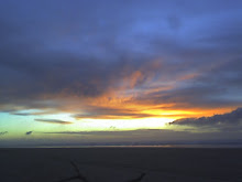
fav Tina Turner tune). So I began to ask my dad and friends as well..when was the last time the beach was sustainable? We talked roads and ferries and electric light plants and on and on and on about when food begin to be imported (think canned food or staples like or sacks of rice, salt, sugar, or flour).

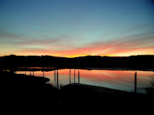
Here's what I came up with. The beach was pretty sustainable before about 1870-1880. I by beach I mean from Knappton-Chinook to Leadbetter Point. Before that period, in migration was slow, a few settlers, a few Natives. It is likely that the population at that time was less than it was 100 years earlier as the Natives had suffered the disastrous effects of epidemics (a theme I will return to) and the several thousands that inhabited Pacific County up to around the late 1700's had been reduced to a few hundred.

  1. Local food production was high (milk, beef, vegetables, fish, shellfish) and/or gathered (think hunting, clamming, oystering, etc.)

  2. Local building materials (sans nails and concrete) were plentiful and well used and that means local timber.

  3. Local transport was foot, wind or sun powered (horses).

  4. Local energy use was human power, horsepower, wind power, with some very likely modest inputs of coal and oil (think lamp oil).
By the late 1930's (6o years):
  1. Roads and vehicles connected the beach with SW Washington and Oregon.

  2. A local light plan powered light bulbs in homes.

  3. Coal and oil are imported energy sources.

  4. Internal combustion engines had replaced steam engines and steam engines had replaced by the former) replaced sailing vessels.

  5. Cars replaced horses.

  6. The train (clamshell railroad) had been and gone.

  7. Food was starting to be imported more frequently via newly built roads

  8. Building materials (plaster, concrete, steel, wire mesh finish lumber, etc.) began to be imported
By the 1970's
  1. Bridges replaced ferries and the road network is upgraded

  2. No local milk production...the dairies are long gone.

  3. No significant local beef production (which is to say, no locally sourced meat markets).

  4. No local green grocer (other than the farmers markets).

  5. All energy sourced from out of the area (nearly 100%) and that includes, oil, propane, gas and electricity. The local contribution of wood declines and/or is being replaced by pelletized wood imported from outside the area.

  6. Building materials..nearly if not 100% imported with the exception of crushed rock and sand (no concrete, asphalt, metals, glass, etc. is locally produced of course). I would hazard to guess that of all the trees cut in Pacific County, very few end up in local construction.


Today we are truly supported by the outside. Oddly enough, one trend is probably true today as it was 100 years ago and that is our death rate exceeds our birth rate and that only reason the population on the beach grows is due to in-migration. Without in migration, our population would retract and in a few decades we'd be like the Dakotas or Wyoming..a shrinking population.

I also like to think of sustainability as elegance of action. A small amount of energy leveraged to a cumulative use to extract more efficiency out of most anything. A really good example was a program sponsored by WSU nearly 20 years ago where by a researcher went out to farmers and demonstrated how a tractor tune and clutch adjustment up could save fuel by making the engine 1) run more efficiently and 2) making the most use that power by getting it to the ground..which equals tractive horsepower. He went out with a portable dynanometer and demonstrated before and after. This is why we use lower wattage bulbs, low flow water fixtures, pump up the tires in our vehicles, etc.

I've been puzzling over when the "beach" made a transition from locally sustainable to something else. This transition was probably around the late 1920's to mid 1930's and can be measured in a couple of ways, but three is one way in particular and that has to do with how we use energy.

Years and years ago, my Dad and I were talking with Ed 
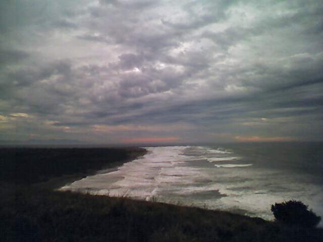
Chellis (born and raised on the beach) and he commented about how open the beach looked back in the day and that there were two primary reasons. One was that the train used pine trees for fuel thus beach pine and spruce where cut for the fire box, the second was the train belched smoke and sparks and was always catching the grass on fire and the third was the open range allowed stock cattle/horses to browse and graze. Dobie Wiegardt commented that you could easily see the Klipsan Life Saving Station from Aunt Anna's house (Potrimpos Gallery on Bay Avenue). There were also fewer drainage ditches and more wetlands, thus open space.

Ed remembered skating to Oysterville from Ocean Park by way of a lake (long gone) that lay in swale a ways east of the Methodist Church Camp.

The principal mode of transportation, that of a tree fed train and grass fed horses resulted in an altered landscape. By the late 1930's the train was long gone and cars and roads had replaced horses for nearly two decades. Cars needed fuel, roads went from hand and horse built to tractor built, ferries needed steam power and went from wood and coal fired to oil fired boilers.

Thus use of coal and then oil to power generators resulted in light plants being built and Ilwaco had a light plant (Astoria as well). Doug Miller told me a few years ago that it was not surprising that that the first use of those plants was for lights thus "Light Plant". A 25 Watt service to a house was not uncommon and that lit a bulb, one 25 watt bulb!

As dams were built on the Columbia River, we went from using ancient energy (oil) to meltwater energy (snow) that flowed down the Columbia. I say flowed down the Columbia because most of that snow pack is in Canada and not in Washington, Oregon, Idaho, Wyoming, Utah, and Nevada. This watershed maps shows the real deal.
So where am I going with this? Well that small cumulative and molecule by melting molecule process of water melting is what powers us. It used to power fish but no more.


Here we are, at the mouth of the Columbia (which reminds me..if we are the mouth..where is the rest of the anatomy?) living off melting water.

Monday, January 26, 2009

Creaking Frogs

Creaking Frogs

For those of you following the weather, I heard the first New Year frogs croaking..more like slow croak, (imagine an old gate with a rusty hinge swinging every so slowly)... about 11 days ago. They are not very lively and two or three croakers does not make a chorus but post December weather, they were probably fooled into thinking that Spring is just around the corner. A mosquito buzzed me at Peninsula Golf on the weekend so a lot of time clocks are running fast this year. Then again, we are almost into February. Take a look a the various plant buds around your yard and your likely to see a lot of forced buds that are within a week of opening (pussy willows are already starting). The large anthill out west of us was dug up (bear perhaps) for the ant larvae and eggs.

Coyotes were yipping west of Seaview a few nights ago and remember, it only takes 2 coyotes to raise a ruckus and sound 2 dozen partying teenagers. Paul Luethe stopped by today and commented the repeat sighting of a small Cougar (100 pounds and I mean feline cat) in "North Seaview".

Thursday, January 15, 2009

Nemah

Nemah

As I was blasting back from Olympia last night, this sunset image revealed itself just past the old Nemah Cafe. This is a small slough aptly named "Tide Slough" in the middle of the Nemah flats. The evening winter air was cool and a low fog formed over the salt marsh. The North Nemah River is just south of here about 400 yards. There is an old log dump at the North Nemah Bridge that was served by a logging railroad. Some of the piling and bulkheads can still be seen upriver of the bridge. Not to far from here was a WWI Spruce Division US Army logging camp that was setup for solidiers to assist in logging to provide wood for the war effort.
In the 60's and 70's, the Nemah (above the lowlands) was a favorite elk hunting area and the Cafe was operating. Most of the patrons where loggers. Two other cafes on 101 where also operating up until about 1960 or so. The Hunter's Inn was located just west on 101 from Johnson's Landing (US 101 and SR 4 intersection) and the Driftwood Inn at O'Meara Point (south of the USFWS office about 2 miles). These Cafe's are long gone for many reasons but one is that as logging got more effiecient, smaller crews became the norm, thus fewer men worked the woods. The other reason is probably related to better roads and vehicles, thus travelers didn't have to stop so often for whatever reason.

Monday, January 12, 2009

Condor

Condor,

I suppose I could write a novel on this project and give me time as I will. Suffice to say that I respect any public art for the sheer improbability of it ever happening.
Here is Bart Kenworthy, scupltor, as he contemplates the bird. Bart worked his tail off putting the big bird together in clay and just like a Condor, Bart's one tough bird as well.


The Condor Project was sponsored by a local not-for-profit organization; the Pacific County Friends of Lewis and Clark. They formed up about a decade ago to sponsor and support educational programs and projects that had some connection to the Lewis and Clark era. To get the Condor done meant raising money, finding a sculptor, finding a location, getting the sculpture finished, mounted, etc. This was completed in the fall of 2008 and the Condor is finished and proudly displayed at the Port of Ilwaco (just west of the ShoreBank Building).
So...how to make a condor? Well..first Bart does up the condor in clay. Then a mold maker turns the clay into molds which are then turned into forms to make wax molds that can be cast (lost wax process).

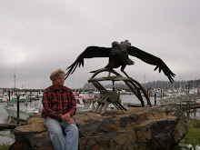
Fresh out of the molds, the parts look pretty clean and not to impressive. Here are some pieces of the condor including the tail and whale bones. The fellow on the left is welding a whale vertebrate together. This is exacting work as the entire piece must look exactly like a vertebrate with no sign of it being welded. Which then is assembled into the "backbone" so to speak. This became part of the base of the sculpture.

Then the pieces are "mocked up" as the chasers begin to figure out how to assemble the final sculpture and weld it together. As you can see, we are clearly getting to looking like a bird.


"And in the end....."


Dune Grass

Dune Grass

At some point I'm going to write about dune grass and ocean edge ecology. Until I get rolling on that you'll have to amuse yourselves looking at this all American dune fire from April of 2002. The images of the kite, Lewis and Clark columnar basalt rock, off-road beach rig, smoke, flame, volunteer fire fighters and American flag..left me at a loss for words then and now.

Saturday, January 10, 2009

Spartina Wars

Spartina Wars

So your looking at this funky machine and this site aspires to natural history and your wondering what the hell is so natural about this! Well that is the point and time will reveal the nature of this history. This weird vehicle represents just a tiny bit of the heavy artillery employed in the War..an ecological war of wars yet to unfold. Dave Milne, my co-conspirator and often partner in ideas, and I hauled this sucker down from Taylor United's Bellingham ops via the Keystone-PT ferry and then, after fooling around with it for a few years, we hauled to WSU Pullman so it could enter a 3rd life as a test bed for other aquaculture uses. We got some interesting looks on the freeway.
Back in 2001, Dave and I spent some serious time looking at how Spartina could be crushed into oblivion. One of our favorite mud vehicles was the 4450 Rolligon. It worked pretty well as long as it was running (hydraulics, flat tires, etc). We did these tests on a thin dime but learned quite a bit as to the amount of force that it would take to crush the root structure. The idea came from Jack Wiegardt's experiences with a big Oliver tractor and that repeat driving over the root structure of the plant killed it. Doing this on a agricultural scale (as in thousands of acres) was possible but it required an application of terrestrial ag systems to an estuary and that is no mean feat. Most soft mud substrates can only be traversed by vehicles (other than an air boat)with .5 psi ground loading and that is serious low pressure tires/tracks, etc. and typically what a sno-cat can produce. And just because you can drive out there doesn't mean you can pull anything. Mud shears pretty easily thus tractive power, that is power to pull something, is limited by the wheel or tracks ability to grab ground and move ahead. After stewing about this and observing the USFWS's Quality Machine tracks in Pot Shot Slough, I ended up concluding that the vehicle's tracks or wheels/tires would be the easiest way to get ground penetration. Ed Erola (Chinook boat builder extraordinaire...I think he's about retired) and I came up with a large wheeled vehicles whose steel wheels were the "implement". Years later I came across this unusual vehicle designed to chug through exotic weed infested wetlands and it wasn't to much different from what Ed and I sketched out. To make it really interesting I concluded that it should be built of wood and burn Spartina to power a steam engine.


This machine (below) is an example of an amphibious tracked device. Good for exploration and access but limited in tractive power, that is an ability to pull something heavy.


Here is a sno-cat that had good tractive power. Sno cats are designed to push, grade, rototill snow and ice as they groom ski hills. Of course, it can't float so god help you if you get into trouble on the flats with the tide coming in! I'll rework this post in the future to explore these subjects. This sno cat towed this big roller I had built (thanks Dale Jacobson! for the roller part) and tested.


This roller [Sayce I] was made from an old sheet press, which was nothing more than a 1/2 inch shell mill roller about 10 feet long and weighing a ton+ It was big and heavy but in the end it had too much flotation. That is an example when size mattered and in this case, it was to large as it could not generate the proper amount of down force, even though it could "knockdown" the plant, it was not adequately crushing the root structure. Live and learn.


This is the Heckes-Sayce I roller. I got this on permanent loan from John Heckes and then Dave and proceeded to destroy it towing it across the mud flats testing it up in Oysterville. What made it work well was that it was narrow and had big angle iron flanges that penetrated into the mud. The tow rig was weak and the water tank that formed the core structure was weaker. When filled with water it was heavy, narrow and had all the right stuff to get to the Spartina root structure and it worked well till it hit a few stumps, piling, and just plain leaked and fell apart. I should have filled it with concrete.

I finally concluded that you had the ability to tow/pull and implement (an open question), then then a "Yap Wheel Gang Roller" might be the set up. At some point I was going to hunt up an old Sheep Foot roller (typically towed by a big cat, say a D-6 +) and try that out in the next stage of evolution as that type of roller was bascially two narrow water filled rollers with compressive "feet" (hence the name a "Sheep's Foot" roller). One point is that the root structure may have needed to be cut more than crushed, thus a penetrating disc might work just as well. Dave and I never got that far into our tests to experiment with cutting vs. crushing the roots.

Salmon Altar at the Isthmus

Salmon Altar at the Isthmus

Before State Parks redid the boat launch area at Cape D and before Maya Lin/Confluence project got involved, there was this simple stainless sink. On this day a troller happened to be motoring out to sea and I caught the shot. The table, where salmon are gutted and cleaned (no nice way to say that), the bay/river water, the boat, pretty much sum up our relationship with fish.

Gray January

Gray January


I was awaiting to be picked up at Astoria Ford when this photo appeared. The combination of sunrise, Saddle Mountain, morning light and the remains of the "mudsticks" was just too good to pass up. The piling represent the evolution of the natural resource industry. A marine "way", that is a ramp for hoisting boats in and out of the water and boat shop crosses from left to right and intersects an old train trestle that used to serve a sawmill located up Youngs Bay. CRPA used to build gilnetters at boat shops that were served by such ways. Which came first? Probably the sawmill, which was out of service when the boat shop was in service as the two uses appear mutually exclusive at this location. The photo is representative of change (boats , trains, and tide) and endurance (mountain and sun).


Monday, January 5, 2009

A View West

A View West


Oh see one en vue!
This is one of my favorite photos because it was taken at nearly the exact moment that a tsunami was supposed to strike the beach, sometime around 8:40 pm April 17, 2005! What was really difficult was to get the cell phone take a picture with the lighthouse light lit up at the exact right time. Dian and I had heard of the warning so we cruised on up to the North Head Lighthouse (passed a jam of fire trucks/emergency vehicles at the Beard's Hollow Overlook). We walked out to watch a spectacular sunset with 50 other like minded folks. Of course...those of you reading this blog might want to look up the history of what happened to the Scotch Cape lighthouse on Unimak Island when a 42 meter tall tsunami hit it (it was wood..not masonry like North Head). If you look left of the lighthouse, you'll notice ocean swells, one of which extends from the edge of picture to the headland and I like to think that's the "wave" from wherever it origininated (probably Aleutian Islands).

That's also code for too much L and C on the brain. 2009 is here and 2000 seems like yesterday. 1/10th of the new century is rapidly rolling up so it's time to kick the tires and light the fires. In the coming months I shall (attempt) to bore into..in no particular order: Beach ecology, global climate change, weeds, man and nature, local historical stuff here and there, the future of kind, the truly weird, pine trees, tsunamis, dogs, groundwater, etc. Some politics thrown in. Stay tuned.

Jim

Followers

About Me

My photo
Seaview, Washington, United States
I live a mile from where I was born but sometimes I feel like a stranger in my own strange land. Descendant from gold miners (The Yukon and Mexico), coal miners (Wales, British Columbia and Washington), timbermen (Sweden), sod and berry farmers (Missouri, Washington), Klondikers, fortune seekers and just plain hearty peasant stock.